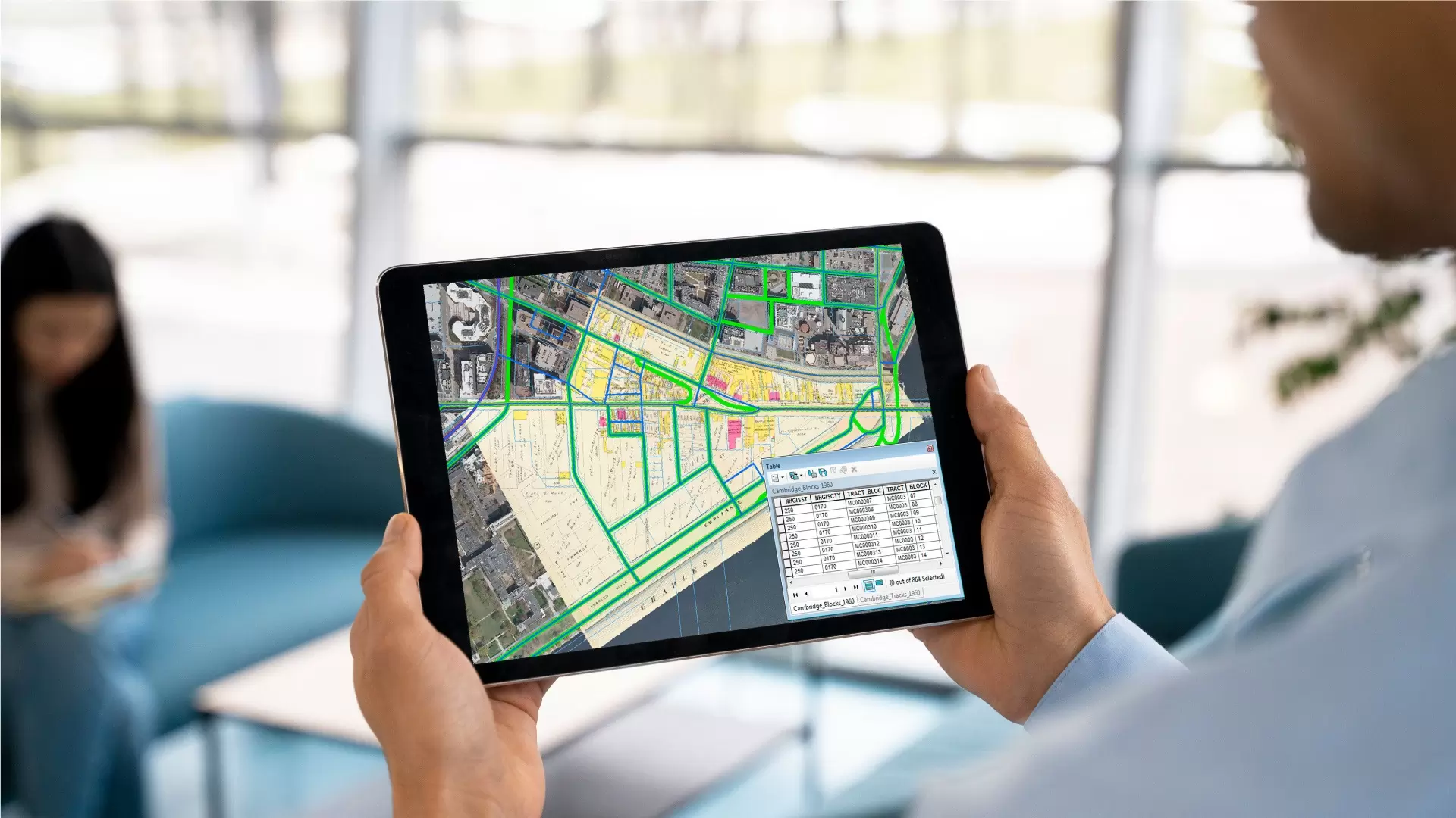
Levar Enterprise Inc is a trusted provider of cutting-edge LiDAR data solutions, delivering high-precision geospatial intelligence to power decision-making across a wide range of industries. From transportation and utilities to construction, forestry, and environmental management — we help businesses see the world more clearly through advanced 3D mapping and data processing.
With a team of experienced geospatial professionals and LiDAR specialists, we offer end-to-end services, including data acquisition, classification, analysis, and visualization. Our solutions are tailored to meet the unique needs of each project, ensuring accuracy, efficiency, and actionable insights.
At Levar Enterprise Inc, innovation drives everything we do. We harness the latest in LiDAR technology and software to support infrastructure development, asset management, and environmental sustainability. Whether it’s aerial, mobile, or terrestrial LiDAR, our team is committed to delivering results that exceed expectations.
To empower industries with reliable and accurate LiDAR data solutions that drive smarter planning, safer operations, and more sustainable growth.
Let Levar Enterprise Inc be your partner in turning complex terrain and infrastructure challenges into clear, data-driven strategies.


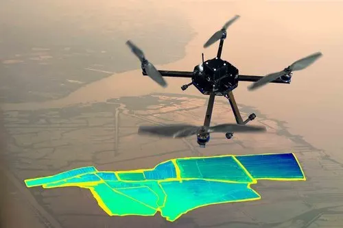
From high-resolution aerial surveys to AI-powered drone mapping and LiDAR analytics, Levar delivers accurate, scalable geospatial solutions tailored to your needs. Our end-to-end services—captured by in-house pilots and enhanced with cutting-edge technology—provide the clarity you need for infrastructure, agriculture, environmental monitoring, and beyond.
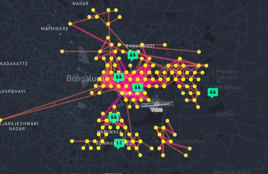
At Levar, we transform raw geospatial data into actionable intelligence. Using advanced analytics, AI, and machine learning, we extract meaningful insights from aerial, drone, and ground-based surveys—helping you map trends, optimize resources, and solve complex challenges.
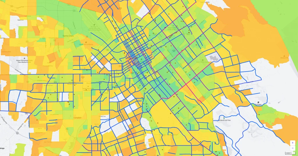
The commercial geospatial data and mapping platforms empower businesses with actionable location intelligence for industries such as retail, logistics, real estate, and agriculture.
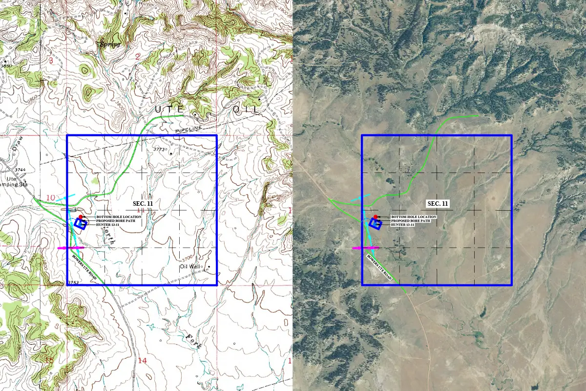
Levar’s advanced aerial survey capabilities include manned flights and cutting-edge drones, delivering high-resolution geospatial data for precision mapping. Our fleet of aircraft and UAVs (Unmanned Aerial Vehicles) is equipped with LiDAR, multispectral sensors, and high-definition cameras to capture detailed terrain, infrastructure, and environmental data.
At Levar, we provide end-to-end program support for your geospatial initiatives, ensuring seamless integration, efficient workflows, and data-driven decision-making.