From high-resolution aerial surveys to AI-powered drone mapping and LiDAR analytics, Levar delivers accurate, scalable geospatial solutions tailored to your needs. Our end-to-end services—captured by in-house pilots and enhanced with cutting-edge technology—provide the clarity you need for infrastructure, agriculture, environmental monitoring, and beyond.
At Levar, we transform raw geospatial data into actionable intelligence. Using advanced analytics, AI, and machine learning, we extract meaningful insights from aerial, drone, and ground-based surveys—helping you map trends, optimize resources, and solve complex challenges.
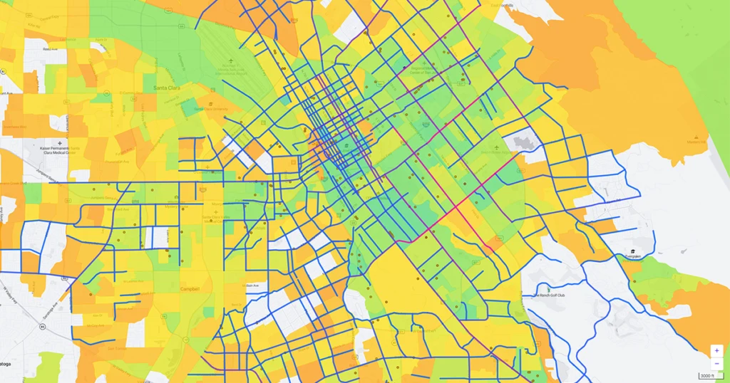
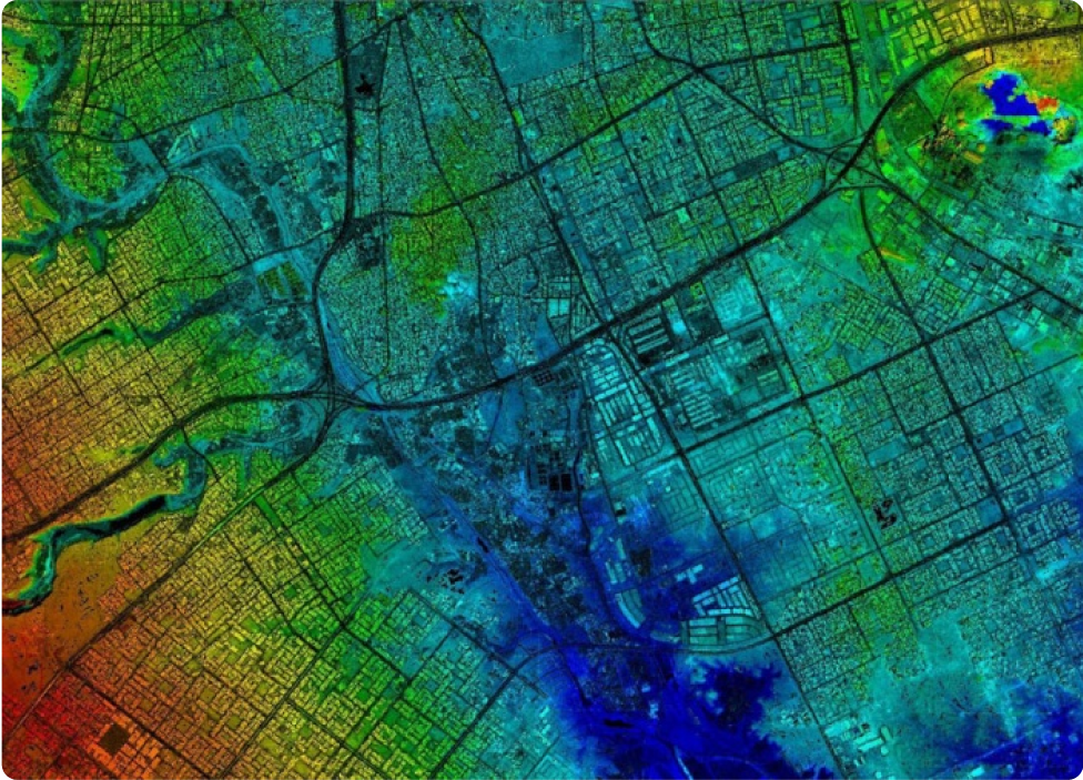
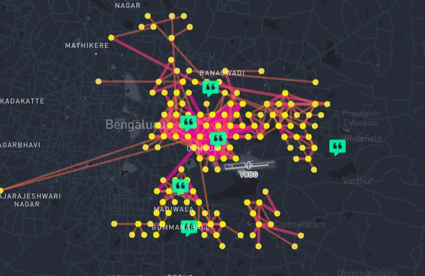
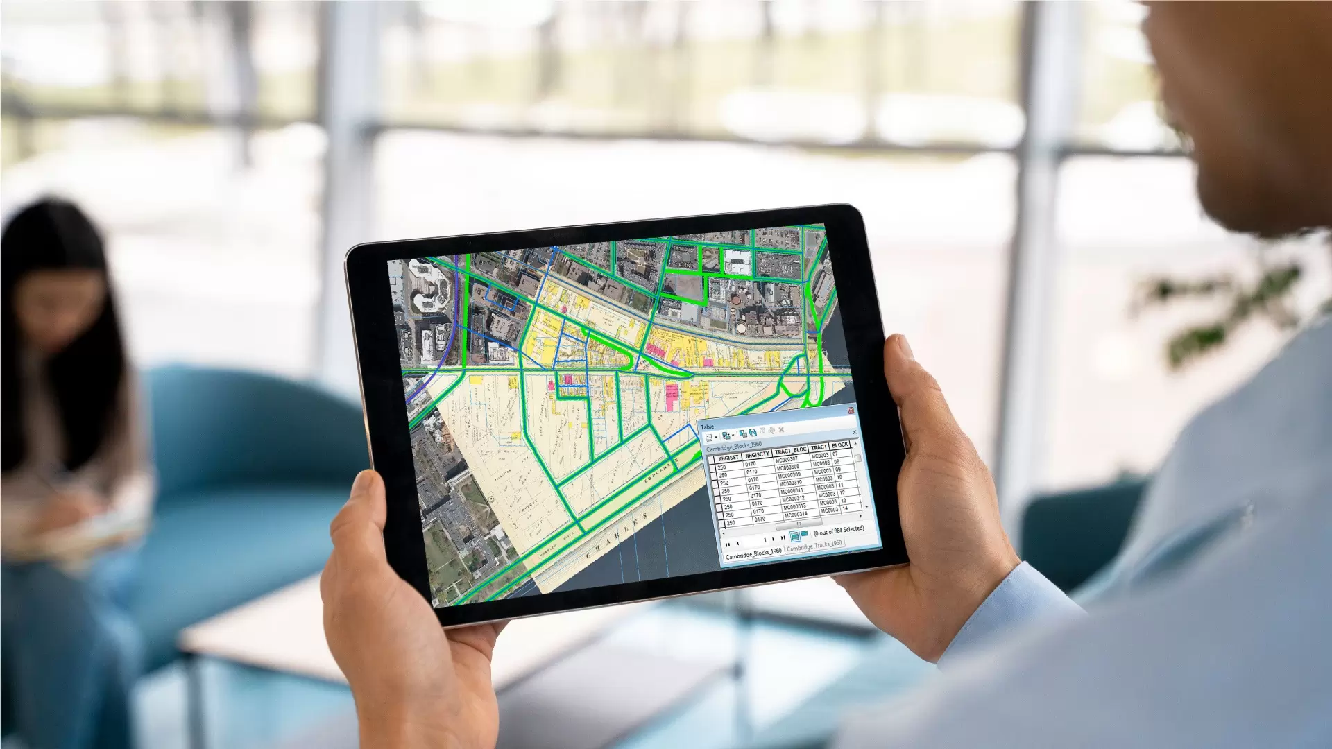
The commercial geospatial data and mapping platforms empower businesses with actionable location intelligence for industries such as retail, logistics, real estate, and agriculture.
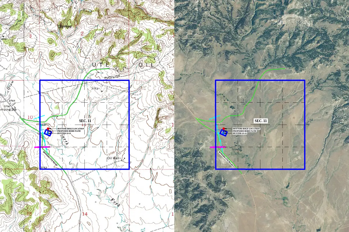
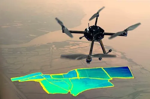
Levar’s advanced aerial survey capabilities include manned flights and cutting-edge drones, delivering high-resolution geospatial data for precision mapping. Our fleet of aircraft and UAVs (Unmanned Aerial Vehicles) is equipped with Ldata-tabAR, multispectral sensors, and high-definition cameras to capture detailed terrain, infrastructure, and environmental data.
At Levar, we provide end-to-end program support for your geospatial initiatives, ensuring seamless integration, efficient workflows, and data-driven decision-making. Our experts deliver customized solutions—from GIS system design and data management to application development and training—tailored to your project’s needs.
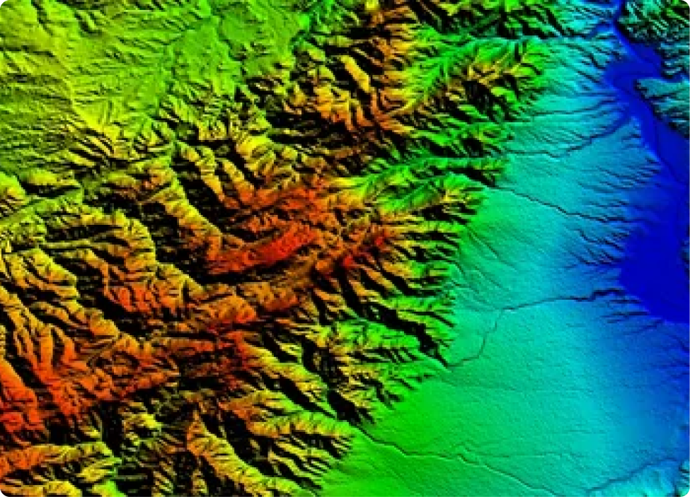
LiDAR (Light Detection and Ranging) is an advanced remote sensing technology that uses laser pulses to measure distances and generate precise 3D information about the shape and surface characteristics of the Earth and man-made structures. At Levar Enterprise, our LiDAR systems are capable of capturing millions of data points per second, offering unmatched spatial resolution.
We specializes in delivering high-accuracy LiDAR Laser Scanning data for a wide range of industries, including construction, utilities, transportation, mining, forestry, urban planning, and more. Our cutting-edge LiDAR data solutions enable faster data collection, detailed 3D modeling, and efficient project planning.
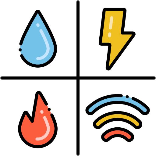
Optimize grid management and asset tracking with Levar’s geospatial solutions—from pipeline inspections to renewable energy site planning. Enhance reliability and reduce downtime with precision mapping and AI-powered analytics

From site surveys to as-built verification, Levar delivers high-accuracy drone and LiDAR mapping for faster, safer project execution. Minimize risks and maximize efficiency with real-time geospatial data.

Engineering-grade topographic data, hydrology modeling, and terrain analysis—Levar’s geospatial tools support resilient, data-driven design for roads, bridges, and flood control systems.


Boost crop yields and resource efficiency with Levar’s NDVI maps, soil health analysis, and irrigation planning. Turn fields into data-driven assets with hyperspectral and drone-powered insights.


Rail corridor monitoring, route optimization, and infrastructure inspections—Levar’s geospatial intelligence ensures safer, smarter transportation networks with centimeter-level accuracy.


Monitor forest health, track carbon sequestration, and combat deforestation with Levar’s LiDAR and multispectral mapping. Sustainable forestry starts with precise geospatial data.


Maximize resource extraction and site safety with Levar’s volumetric analysis, slope stability mapping, and drone-based stockpile measurements. Mine smarter with real-time geospatial intelligence.

Shape future-ready cities with Levar’s 3D city models, zoning analysis, and IoT integration. From traffic flow to green spaces, we turn spatial data into actionable urban insights.